


Hiking Ala-Kul Lake in Tian Shan Mountains, Karakol, Kyrgyzstan
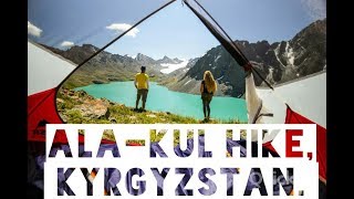
There are more hiking opportunities in Central Asia than you could imagine, the whole country is criss-crossed with hiking trails... This post will discuss our experience hiking up from Karakol (east end of Issyl-Kul) up to Ala-Kul: a rock-dammed lake situated around 3500m altitude, in July 2017.
The Karakol - Ala-Kul hiking route is one of the most popular tourist spots that we found in Kyrgyrzstan. There were more tourist hikers here than anywhere else, BUT this does not mean it was over-crowded in any way,
The hike can be done from either direction, but we chose the route:
Karakol (1500m altitude)
Ak-Suu (1800m altitude)
Altyn Arashan (2400m altitude)
The Pass (3800m altitude)
Ala-Kul (3500m altitude)
Alpalager (2200m altitude)
Karakol (1500m altitude)
This was because we understood the route to be easier this way around, after assessing distance and altitude inclines. Also, at our time of hiking in July 2017, this route had transport from Ak-Suu to Altyn Arashan, which would make this hike a lot easier if necessary. There is no paved road, but there are many 4x4's and big military-style trucks that can pass along this route.
Day 1
We travelled from Karakol to Ak-Suu by taxi for 250 Tinge. This journey took around 30 minutes and our driver refused to go further than Ak-Suu because the road became a dirt track. We walked around 1km past a camping ground and found a perfect camping spot with beautiful valley views, not so close to the river so we could sleep very well because we avoided the noise from the constant moving water. But at 6am a man on a horse stopped by and asked us to pay 200 Som… There was a sign in Russian that we couldn’t understand so maybe that explained something, but as neither of us can read Russian.... Otherwise, we had a very good and comfortable sleep.
Ak-Suu (1800m altitude) to Altyn Arashan (2400m altitude) is a relatively easy hike along a dirt road, through alpine forest and along a strong but small river. The first 5km we completed in 2 hours, then we had lunch and walked another 5km in 4 hours because the path begins to ascend very steeply and the weather was around 35degrees Celsius or more.
Just before Altyn Arashan there in a section of road that ascends very steeply, for around 100m altitude you will be walking at around 45% incline. After this you willl come over the crest of a hill and there is a slight path to the right that leads sharply downwards towards the river, after 10 minutes following a very slim hiking path you will find 2 natural (and free) hot springs. The first is obviously on your right and can sit around 4 people, the second is hidden behind the next piece of rock and fits around 6 people comfortably. It is suggested to get in the hot spring, take a quick dip in the river, then back into the hot spring.
At Altyn Arashan there are also Yurt camps and camping spots, these ‘guest houses’ offer their own hot springs. We did not stay in this mountain village because we walked another 45 minutes (around 2km) to a grassy pasture situated 500m from the right hand turn up towards Ala-Kul.
Around 6pm we pitched the tent on a grassy knoll, cooked some dinner on our gas stove and went to sleep early.
Transport to Altyn Arashan Wild strawberries View as the path ascends Altyn Arashan
Day 2
We woke up to the sound of horses hooves, as they galloped past us in the morning sunlight. We had a lazy breakfast and only left our camp site around 10am. After this we had 500m until the right hand turn to walk up along the river. This path is through a pine forest and is very pleasant for the first couple of km, before you reach the tree line and head towards the river crossing.
The river crossing is not very obvious. If you don’t have a map it's very easy to miss. So I would suggest to have some kind of App-Map at least (we use Maps.me). It is also not an easy crossing, if you don’t have waterproof shoes you will have to walk across barefoot in freezing mountain water. Then walk up a steep inclide and the left towards a small hut. Past this hut there will be a Yurt camp in a couple of km. We hid from the rain here, and were offered tea for an expensive 200 Som, before heading towards the final incline.
The next section, around 3km, is really beautiful, simple and easy… Until the last 350m incline. At this point your map will say you have 650m distance to cover. It took us almost 2 hours to walk this distance.
You will find yourself at the end of the valley, wondering where on earth this path goes as there is no obvious route up and over the pass. You’re at 3500m so you may also feel out of breath. Take it slow here. Hiking poles (or solid sticks picked up earlier in the pine forest) are very recommended. Walk in pretty much a straight line and you will see a path heading up - very steeply - to ‘the pass’. We walked across an area of around 60m of snow, then started the incline which takes you up a wall of loose rock. This terrain means you will take 3 steps up and slide down 2. It is the most difficult section of the hike.
For us, it was made more difficult by the weather because we hit a thunder/hail/snow storm. This also meant when we reached the top we had very little to see and started our decent to Ala-Kol lake pretty much instantly.
From the pass you can see the camping spot that is officially on your map, but there is another 1.5km of walking across loose rocks to get to this spot. We walked for 1 km then found a good spot and pitched our tent for the night.
River crossing Lunch time Our first view of Ala-Kul Stormy, snowy view Our morning view of Ala-Kul Morning views Featuring our MSR tent @Vagabonshoe
Remember - You will be sleeping at 3500m altitude. It will be cold. It can be uncomfortable if you’ve ascended quickly. You can get altitude sick if you’ve not been at this altitude before… Or even if you have, you should be aware of the risks of altitude sickness and descend as soon as you start to feel any symptoms. Follow THIS LINK for more information.
Day 3
After a restless night for Maddy and a good nights sleep for Reggie, we woke up with the sunshine around 9am and thawed out. We worked hard enough to get to Ala-Kul that we enjoyed the morning here - having breakfast on our own gas cooker - and only started to hike again around mid-day.
From mid-day to 5pm we covered 5km. This downward section is very steep and hard on your knees. Following the river and predominantly without cover over-head. Terrain varies from loose rocks to dirt paths and parts are around 45% incline.
After 5 solid down-hill km’s, you will find yourself at Alplager camp site which is scenically placed in the Ala-Archa valley that leads back towards Karakol.
From here you can usually get transport, but at our time of hiking in July 2017, the roads were covered by multiple rock-falls and land-slides, and was completely washed away in one section. However, this section is an easy down-ward hike along a dirt road (mainly), which does cover a large distance but isn't as strenuous as the other sections you have completed.
We walked 12km in 3 hours and found a car heading to Karakol for the last 10km or so (for 500Som). If you arrive before 8pm-ish there are usually mini-buses going to-and-from Karakol/the collapsed bridge around 8km from Alplager… If you arrive after 8pm you will need to hitch a ride and pay a decent amount for it.
Ala-Kul waterfall View down the valley Alplager to Karakol road
After 3 days of hiking and one of the hardest physical experiences of my life, I would say this hike is a definite must for anyone planning to hike in Kygyrzstan. The beautiful landscapes and the other hikers you’ll meet make for an interesting and ever-changing experience. There are also many opportunities to stop and rest, or you can add another couple of days hike by walking onwards from Alplager and across another valley towards Jeti-Oguz.
For more information about this extended hike we talked to Max at Zafina's Cafe in Karakol. Max is a very knowledgeable man who speaks very good English and knows a lot about the hiking in this area. If Max can’t help, there are many tour operators dotted around the main high street that can also help, or can arrange transport and other tours.
In Karakol, other than Zafina’s Cafe, we would also suggest Karakol Coffee, which do lunch box’s for 350Som for hikers, and have an amazing breakfast of eggs, sausages and salad. Zafina's Cafe and Karakol Coffee are situated next door to each other:




Comments